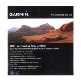
* FREE DogMaster OSM + Topo Map
* Two-way radio communication
* Transmit power: 5 watts UHF Citizen Band Radio Service UHF CBRS
* Emergency Alert
* Weather Overlays
* Smart Notifications
* Barometric Altimeter
* Electronic compass
* GPS / GLONASS dual Satellite Reception
* 3" Colour Touchscreen with Dual Orientation
* Extra Garmin maps support with microSD card slot
* Waterproof (IPX 7) and rechargeable
Download Garmin Rino 750 Manual From here.
Important ! Please perform software and firmware update for Garmin products before use.Garmin Rino 750 Two Way Radio GPS Handheld Navigator
- Brand
- Garmin
- SKU:
- 94-GAH-021
- UPC:
- 753759160890
Features
* Two-way radio communication
* Transmit power: 5 watts UHF Citizen Band Radio Service UHF CBRS
* Emergency Alert
* Weather Overlays
* Smart Notifications
* Barometric Altimeter
* Electronic compass
* GPS / GLONASS dual Satellite Reception
* 3" Colour Touchscreen with Dual Orientation
* Extra Garmin maps support with microSD card slot
* Waterproof and rechargeable
The new Rino 750 2 way radio GPS handheld device combines with the latest Garmin GPS & Glonass satellite technology and high output radio device for extreme outdoor adventurers.
What's new in the Rino 750 series?
GPS / GLONASS dual Satellite Reception
The GLONASS is the Russian Navigation Satellite System which has 24 orbital satellites which means the new Rino 750 is able to receive 24 more satellite signals than the previous Rino 650 handheld.
Wireless share
The Rino 750 works with compatible smartphones to receive messages so you don't need to have two devices on hand all the time. It also supports Bluetooth connection which means you can talk to your friends via Bluetooth handsfree devices.
Screen Display
The new Rino 750 has a bigger 3 inch high resolution touch screen where the Rino 650 only has a 2.6 inch standard resolution screen. With a bigger and better display, you can easily read maps and navigate around more accurately.

Other features:
Find Your Friends
Rino series handhelds feature a unique Position Reporting capability that lets you send your exact location to other Rino users so they can see it on their map page.
Pinpoint Your Position
With its high-sensitivity GPS and GLONASS receiver and quad helix antenna, Rino 750 quickly finds your position and maintains it — even in heavy cover area. Plus, with a built-in barometric altimeter and a 3-axis electric compass make it easy to get your bearings without needing to hold the unit level.
See Your Surroundings
Rino 750 handheld comes with a worldwide, shaded-relief basemap. With the wide array of detailed Garmin marine, road and outdoor maps available, it’s easy to install extra maps.
Keep a Close Eye on the Weather
The Rino 750 series supports the Active Weather forecasts and animated radar tracking which gives you a vital edge in weather awareness. When pairing a compatible smartphone with the "Garmin Connect Mobile" app installed, the Rino 750 will be able to use the mobile network to get real-time conditions, forecasts and alerts (in areas with coverage) directly and display on the screen. For extra safety, the Rino 750 handheld features a built-in NOAA weather radio that can help you avoid the hazardous weather. The radio supports Specific Area Message Encoding, which allows you to see National Weather Service warnings and watches displayed on the map screen.
Plan Your Next Trip
Take charge of your next adventure with BaseCamp, software that lets you view and organize maps, waypoints, routes and tracks. This free trip-planning software even allows you to create Garmin Adventures that you can share with friends, family or fellow explorers. BaseCamp displays topographic map data on your computer screen, including contour lines and elevation profiles. It can also transfer an unlimited amount of satellite images to your device when paired with a BirdsEye Satellite Imagery subscription.
| General | |
| Physical dimensions | 6.6 x 20.1 x 4.1 cm |
| Weight |
348g |
| Water rating | IPX7 |
| Battery type | removable, rechargeable litdium-ion battery pack; AA battery pack (not included) |
| Display type | 3.0" transflective, 65K color TFT |
| Display size | 3.0" |
| Display resolution | 240 x 400 pixels |
| Battery life | up to 14 hours (up to 18 hours witd optional AA battery pack at 2 watts) |
| Memory/history | 1.7 GB |
| Transmit power | 5 watts (UHF); up to 32 kms (LOS) |
| High-sensitivity receiver | Yes |
| Interface | high-speed USB and NMEA 0183 compatible |
| Maps & Memory | Yes |
| Basemap | Yes |
| Ability to add maps | Yes |
| Accepts data cards | microSD™ card (not included) |
| Waypoints/favorites/locations | 10,000 |
| Routes | 250 |
| Track log | 20,000 points, 200 saved tracks |
| Sensors | |
| Barometric altimeter | Yes |
| Compass | Yes (tilt-compensated 3-axis) |
| Outdoor Recreation Features | Yes |
| Area calculation | Yes |
| Automatic routing (turn by turn routing on roads) | Yes |
| Geocaching-friendly | Yes |
| Hunt/fish calendar | Yes |
| Sun and moon information | Yes |
| Camera |
no |
| Picture viewer | Yes |
|
Two-way Radio Features |
|
| Frequency band | UHF |
| Channels | 80 + 38 CTCSS |
| Squelch codes | 38 (CTCSS); 83 (DCS) |
| Range | Up to 32 kms (line of sight) |
| VOX (voice activation) | Yes |
| Location reporting (send and receive GPS positions) | Yes |
| Vibration alert | Yes |
| NOAA weatder radio | Yes |


